
01Free
Plan
Plot your route
Departure, destination and stops. Fluvigo draws the route and estimates the distance, the duration and the number of locks, based on your boat’s dimensions.
 The river navigation and planning app
Grand Prix Essential Equipment · Salon Fluvial 2026
The river navigation and planning app
Grand Prix Essential Equipment · Salon Fluvial 2026
The river navigation and planning app
Designed and built in Strasbourg.Fluvigo is a partner of the Alsace regional brand. We carry the colours of a region where inland waterways have always been part of the landscape — from the Marne–Rhine canal to the Vauban basin, this is where it all began.
Grand Prix Essential Equipment · Salon Fluvial de Saint-Jean-de-Losne, April 2026
An enriched map to anticipate, explore and cruise with complete peace of mind. Plan your route for free, spot your stops, and let Fluvigo watch over the rest.
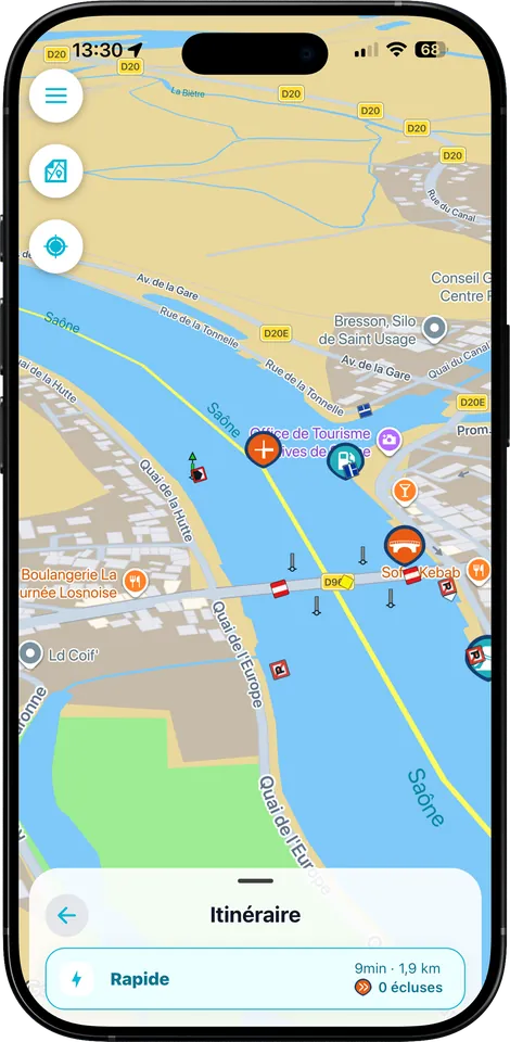
Every marker is designed for life on board: where to moor, where to dine, where to buy the morning bread, and what’s happening in the village on the day you pass through.
 Harbours & mooring stopsBerths, services, harbour office
 MooringsWhere to stop safely
 RestaurantsFoodie stops
 BakeriesThe morning bread
 MarketsDays and times
 Tourist officesInfo and sightseeing
 EventsWhat’s happening on the quayside
Restaurants are already listed in large numbers across most of the sectors covered · the bakery database is growing continuously.
Fluvigo simply separates what helps you plan from what accompanies you while you are under way. No confusion, no nasty surprise when it’s time to leave.
Departure, destination and stops. Fluvigo draws the route and estimates the distance, the duration and the number of locks, based on your boat’s dimensions.

The route and the basic information stay free. Fluvigo+ adds lock opening times, notices to skippers, active restrictions and disruptions.
Real-time position and progress, next passages, AIS encounters and smart proximity alerts.
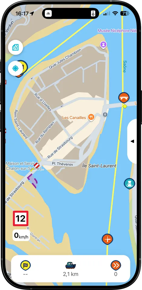
Not a road map with water on it: a view designed for the helm, where every piece of information arrives when it’s needed.
Follow your progress along the waterway and plan your stops without leaving the map.
Tourist sites, markets, activities and good addresses within walking or cycling distance of your mooring.
Bridges, locks, restrictions and limitations are shown on the map with markers you can read at a glance.
“Pont de France at Auxonne — close your bimini”: the alert comes before the obstacle, not while you are under it.
Plan your foodie stops straight from the interactive map. Find the tables near harbours, mooring stops and your route — and spot the bakery that’s open tomorrow morning.
Already listed in large numbers across most of the sectors covered.
The database is growing, sector by sector.
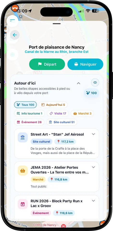
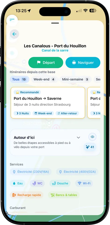
Safer, simpler, smarter: Fluvigo brings together what used to be scattered between the paper guide, the official notices and the skipper’s experience.
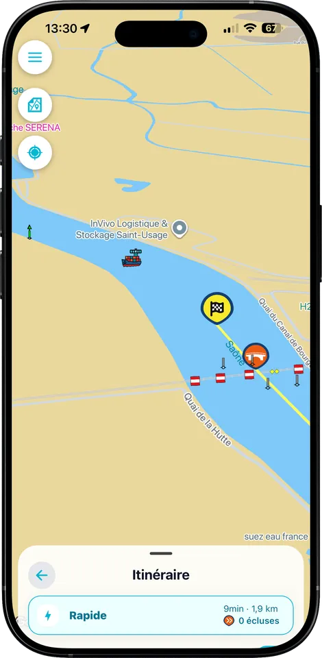
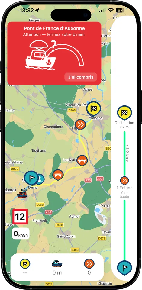
Commercial vessels and other equipped craft appear on the map. You know who is coming the other way before you commit to a bend or a bridge.
Waterway closures, lower water levels, works and clearance restrictions — placed back on your route, exactly where they concern you.
The routes give you the restrictions, a realistic duration, the mooring points and the services available on arrival.
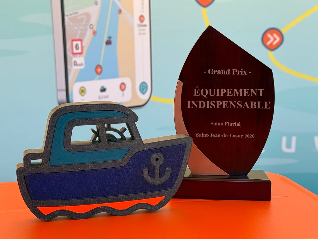
In April 2026, at the Salon Fluvial de Saint-Jean-de-Losne, Fluvigo received the Grand Prix in the Essential Equipment category. A jury of inland waterway professionals, a trophy in Capi’s likeness — and a fine reason to keep going.
Capi, precisely: he’s our mascot, and on board he’s the one who prompts you with the right moves.
“Low bridge ahead.” Close your bimini before you reach it, not when it starts scraping.
“The lock closes in 40 minutes.” At your pace, you’ll be there in 24 — that’s doable.
“Market in the village tomorrow.” Moor here rather than two kilometres further on.
Reviews left on the App Store and on Google Play by boaters who took Fluvigo on board.
App Store & Google Play reviewsENFIN une application disponible pour accompagner nos vacances sur l'eau. Nous avons l'habitude de partir chaque année en bateau sur les canaux de France et en tant que novices (nous n'avons pas de permis) il est souvent compliqué de se repérer et comprendre toutes les indications sur le chemin. Fluvigo simplifie tout simplement la vie, en plus d'être intuitif et facile d'utilisation. Je recommande 100 % !
facile d'utilisation et très intuitive, les icônes sont très sympas et je conseille vivement l'application pour naviguer en toute sécurité
Application sympathique mais surtout performante pour se guider, Capi nous a donné les bons horaires au pont de Frontignan 👍 L'appli nous a aussi beaucoup aidé concernant le balisage sur l'étang de Thau…
quelques difficultés pour ajuster la taille du bateau, donc itineraire impossibe, mais c'est de ma faute. A prioris renseignements complet pour naviguer. pas de hauteur de pont. A voir a l'utilisation
Genuine reviews, unedited and in their original French — « … » marks an excerpt. See on the App Store · See on Google Play
The free version shows you where the route goes. Fluvigo+ tells you what’s happening right now, and stays with you on the water.
No bank card is required to plan a route.
I understand the route before departure and approach the locks with better bearings, even if it’s my first time at the helm.
I register my boat, compare my options and keep the useful information in front of me, season after season.
I share simpler access to information, from a partner base or harbour, and I repeat the same instructions less often.
You stay in charge: Fluvigo lights up the route, the skipper always decides.
All the questionsA river navigation and planning app: an enriched map of the waterways, personalised routes, the services and stops around your route, and enhanced signage information for calmer cruising.
You look at the map, create a route with a departure point, a destination and stops, then get the track, the distance, the estimated duration, the number of locks and the useful places around the route. With no bank card.
Lock opening times, current notices to skippers, active restrictions and disruptions reported along your route. This information is refreshed continuously and is part of Fluvigo+.
No. Standard planning is complete and free. Fluvigo+ becomes useful when you want to adapt the trip to today’s conditions or be guided while you are under way.
Fluvigo is designed as the modern alternative to paper guides: more up to date, richer, always in your pocket. That said, the official publications of the waterway authorities are authoritative, and the skipper remains solely responsible for their navigation.
Scan the code, download the app and plan your route for free. Fluvigo+ will be there whenever you want today’s conditions and live navigation.
Capi is with you from your very first trip — and he knows his locks.
iPhone, iPad and Android · No bank card