
Free
An enriched waterway map
Canals, navigable rivers, locks, bridges, harbours and mooring stops: a map designed for the water, not for the road. It’s the modern alternative to the paper cruising guide.
 The river navigation and planning app
Grand Prix Essential Equipment · Salon Fluvial 2026
The river navigation and planning app
Grand Prix Essential Equipment · Salon Fluvial 2026
The river navigation and planning app
Plan a route, understand the locks, know what’s happening on the water today, spot where to dine tonight and be guided while you cruise. Here are the details.
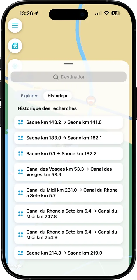
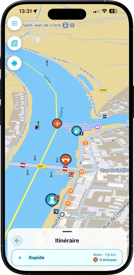
Canals, navigable rivers, locks, bridges, harbours and mooring stops: a map designed for the water, not for the road. It’s the modern alternative to the paper cruising guide.
Departure, destination and as many stops as you need. Fluvigo plots the route, calculates the distance, estimates a realistic duration and counts the locks to be passed.
Length, beam, draught, air draught and average speed: enter your boat once and all your estimates adjust.
Harbours, moorings, restaurants, bakeries, markets, tourist offices, sights and events — spotted around your route.
Opening hours, service periods, automatic or manual locks, opening on request: the information that really shapes how a day unfolds.
Current notices and active restrictions are placed on your route, at the spot where they concern you, rather than in a list to wade through.
Equipped vessels appear on the map. You see a convoy coming before you commit to a bend, a bridge or a narrow reach.
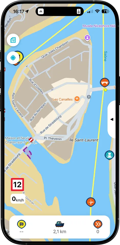
Position, progress, speed, distance remaining and next passages, updated as you cruise.
A low bridge, a lock about to close, a restriction ahead: the alert takes your speed into account and arrives while it is still useful.
 Harbours & mooring stopsBerths, services, harbour office
 MooringsWhere to stop safely
 RestaurantsFoodie stops
 BakeriesThe morning bread
 MarketsDays and times
 Tourist officesInfo and sightseeing
 EventsWhat’s happening on the quayside
A view designed to be read at a glance from the helm: where you are, what’s coming, and how long until it does.
The estimate takes account of your actual speed and the locks still to come, not just the distance.
Lock, moving bridge, low bridge, tunnel, restriction: the next constraint is there, with the time that separates you from it.
Fluvigo informs and anticipates, it does not steer. The official publications of the waterway authorities are always authoritative.
The rule is simple: planning is free; knowing the current conditions and being guided live is what Fluvigo+ is for.
| What you get | Free | Fluvigo+ |
|---|---|---|
| Enriched waterway map and place search | ||
| Personalised routes with stops | ||
| Distance, estimated duration, number of locks | ||
| Boat profile and adjusted estimates | ||
| Harbours, moorings and services | ||
| Restaurants, bakeries, markets, sights | ||
| Saved routes and sharing | ||
| Lock opening times | — | |
| Current notices to skippers | — | |
| Active restrictions and disruptions | — | |
| Route adapted to today’s conditions | — | |
| AIS — commercial and other vessels | — | |
| Live position and progress | — | |
| Smart proximity alerts | — | |
| Navigation active in the background | — |
Scan the code, download the app and plan your route for free. Fluvigo+ will be there whenever you want today’s conditions and live navigation.
Capi is with you from your very first trip — and he knows his locks.
iPhone, iPad and Android · No bank card